Bienvenue dans la photothèque du Laboratoire d'Excellence "Dispositif de Recherche Interdisciplinaire sur les Interactions Hommes-Milieux" (DRIIHM) composé de 13 Observatoires Hommes-Milieux.

Welcome to the photo library of the "Device for Interdisciplinary Research on Human-environments Interactions" (DRIIHM) Laboratory of Excellence.

[ arrêter le diaporama ]

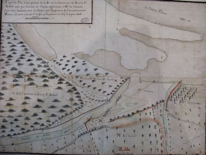
Map (Bourg-St-Andéol, 1808)

278.jpg Map (Bourg-St-Andéol to the sea, 1781)MiniaturesMap (Bourg-St-Andéol, 1846-1847)Map (Bourg-St-Andéol to the sea, 1781)MiniaturesMap (Bourg-St-Andéol, 1846-1847)Map (Bourg-St-Andéol to the sea, 1781)MiniaturesMap (Bourg-St-Andéol, 1846-1847)Map (Bourg-St-Andéol to the sea, 1781)MiniaturesMap (Bourg-St-Andéol, 1846-1847)Map (Bourg-St-Andéol to the sea, 1781)MiniaturesMap (Bourg-St-Andéol, 1846-1847)Map (Bourg-St-Andéol to the sea, 1781)MiniaturesMap (Bourg-St-Andéol, 1846-1847)

Original title (in French): Copie du plan d'une portion de l'île de la commune de Bourg-St-Andéol ainsi que domaine du Chaylar, appartennant à Monsieur de Chauras, levé lors des basses eaux du Rhône. English title: Copy of the plan of a portion of the island in the town of Bourg-St-Andéol, as well as the Chaylar estate, belonging to Mr. De Chauras, surveyed at low-flow.