
210/350
)
)
)
)
)
)
)
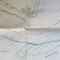
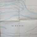
: Construction d'un chemin de halage sur la rive gauche du Rhône le long de la digue de la Tête d'Or sur une longueur de 706 m. English title: Towpath construction on the left bank of the Rhône river along the Tête d'Or dyke over a length of 706 m.")
Original title (in French): Construction d'un chemin de halage sur la rive gauche du Rhône le long de la digue de la Tête d'Or sur une longueur de 706 m. English title: Towpath construction on the left bank of the Rhône river along the Tête d'Or dyke over a length of 706 m.
- Auteur
- Lagorce
- Tags
- Fonds/Photographic fund
- Archives Départementales du Rhône (reference: S 1361)
- Contributeurs/Contributors
- Nature de la ressource/Resource type
- Map
- Date
- Période/Period
- 1842
- Commune/Municipality
- Secteur/Sector
- Lyon (3 km long)
- Echelle/Scale
- ~ 1/5000
- Lieu visé ou point de visée/Targeted place or photographer geolocation
- Projet OHM/OHM project
- Complément d'information/Additional information
- Ressource liée/Linked resource
- DOI
- Copyright
- Creative Commons (BY-NC)