
205/350
)
)
)
)
)
)
)
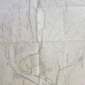
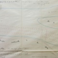
: Carte du Rhône n°3 faisant connaitre les brèches de la Barthelasse et de Villeneuve. English title: Rhône map n°3 showing the Barthelasse and Villeneuve breaches.")
Original title (in French): Carte du Rhône n°3 faisant connaitre les brèches de la Barthelasse et de Villeneuve. English title: Rhône map n°3 showing the Barthelasse and Villeneuve breaches.
- Auteur
- Aymard
- Tags
- Fonds/Photographic fund
- Archives Départementales du Rhône (reference: S 1436)
- Contributeurs/Contributors
- Nature de la ressource/Resource type
- Map
- Date
- Période/Period
- 1856
- Commune/Municipality
- Secteur/Sector
- Avignon (11 km long)
- Echelle/Scale
- 1/10 000
- Lieu visé ou point de visée/Targeted place or photographer geolocation
- Projet OHM/OHM project
- Complément d'information/Additional information
- Ressource liée/Linked resource
- DOI
- Copyright
- Creative Commons (BY-NC)