
171/350
)
)
)
)
)
)
)
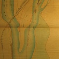
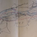
: Plan topographique de la ville de Lyon et de ses environs . English title: Topographical map of Lyon and its surroundings.")
Original title (in French): Plan topographique de la ville de Lyon et de ses environs . English title: Topographical map of Lyon and its surroundings.
- Autor
- Ponts & Chaussées
- Tags
- Fonds/Photographic fund
- Archives Départementales du Rhône (reference: 185 J 6)
- Contributeurs/Contributors
- Nature de la ressource/Resource type
- Map
- Date
- Période/Period
- 1858
- Commune/Municipality
- Secteur/Sector
- Lyon (7 km long)
- Echelle/Scale
- ~ 1/10 000
- Lieu visé ou point de visée/Targeted place or photographer geolocation
- Projet OHM/OHM project
- Complément d'information/Additional information
- Ressource liée/Linked resource
- DOI
- Copyright
- Creative Commons (BY-NC)