
340/350
)
)
)
)
)
)
)
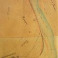
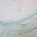
: Plan-terrier de l'abbaye de St-Irénée. English title: Ground plan of the St-Irénée abbey.")
Original title (in French): Plan-terrier de l'abbaye de St-Irénée. English title: Ground plan of the St-Irénée abbey.
- Autor
- NA
- Tags
- Fonds/Photographic fund
- Archives Départementales du Rhône (reference: 1 J 1696)
- Contributeurs/Contributors
- Nature de la ressource/Resource type
- Map
- Date
- Période/Period
- 1730-1740
- Commune/Municipality
- Secteur/Sector
- Lyon (1,5 km long)
- Echelle/Scale
- ~ 1/2000
- Lieu visé ou point de visée/Targeted place or photographer geolocation
- Projet OHM/OHM project
- Complément d'information/Additional information
- Photos from a temporary exhibition
- Ressource liée/Linked resource
- DOI
- Copyright
- Creative Commons (BY-NC)