
1121/1165
)
)
)
)
)
)
)
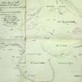
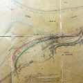
: Construction d'une digue insubmersible sur la rive droite du Rhône entre le pont suspendu de Tournon et la tête de la digue de la Muelle, sur une longueur de 290 m. English title: Construction of an unsubmersible dyke on the right bank of the Rhône river between the Tournon suspension bridge and the head of the Muelle dyke, over a length of 290 m.")
Original title (in French): Construction d'une digue insubmersible sur la rive droite du Rhône entre le pont suspendu de Tournon et la tête de la digue de la Muelle, sur une longueur de 290 m. English title: Construction of an unsubmersible dyke on the right bank of the Rhône river between the Tournon suspension bridge and the head of the Muelle dyke, over a length of 290 m.
- Author
- Kleitz
- Tags
- Fonds/Photographic fund
- Archives Départementales du Rhône (reference: S 1411)
- Contributeurs/Contributors
- Nature de la ressource/Resource type
- Map
- Date
- Période/Period
- 1856
- Commune/Municipality
- Secteur/Sector
- Tournon (8 km long)
- Echelle/Scale
- 1/10 000
- Lieu visé ou point de visée/Targeted place or photographer geolocation
- Projet OHM/OHM project
- Complément d'information/Additional information
- Ressource liée/Linked resource
- DOI
- Copyright
- Creative Commons (BY-NC)