
298/1165
)
)
)
)
)
)
)
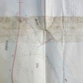
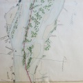
: Projet d'endiguement du Rhône le long de l'Ile de la Table ronde dans la commune de Vernaison sur une longueur de 800 m. English title: Embankment project for the Rhône river along the Table Ronde island in the town of Vernaison.")
Original title (in French): Projet d'endiguement du Rhône le long de l'Ile de la Table ronde dans la commune de Vernaison sur une longueur de 800 m. English title: Embankment project for the Rhône river along the Table Ronde island in the town of Vernaison.
- Autor
- Josserand
- Tags
- Fonds/Photographic fund
- Archives Nationales (France), Archives Départementales du Rhône (reference: F/14/6707, S 1360, S 1387)
- Contributeurs/Contributors
- Nature de la ressource/Resource type
- Map/Long profile
- Date
- Période/Period
- 1846
- Commune/Municipality
- Secteur/Sector
- Vernaison (5 km long)
- Echelle/Scale
- 1/5000
- Lieu visé ou point de visée/Targeted place or photographer geolocation
- Projet OHM/OHM project
- Complément d'information/Additional information
- 3 maps
- Ressource liée/Linked resource
- DOI
- Copyright
- Creative Commons (BY-NC)