
Bienvenue dans la photothèque du Laboratoire d'Excellence "Dispositif de Recherche Interdisciplinaire sur les Interactions Hommes-Milieux" (DRIIHM) composé de 13 Observatoires Hommes-Milieux.
Welcome to the photo library of the "Device for Interdisciplinary Research on Human-environments Interactions" (DRIIHM) Laboratory of Excellence.

Information
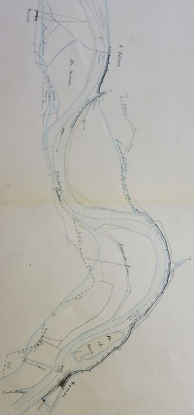
- Author
- Josserand
- Fonds/Photographic fund
- Archives Départementales du Rhône (reference: S 1233)
- Nature de la ressource/Resource type
- Map
- Période/Period
- 1845
- Secteur/Sector
- Lyon to Donzère (168,5 km long)
- Echelle/Scale
- 1/20 000
- Complément d'information/Additional information
- 7 sheets
- Licence
- Creative Commons (BY-NC)
EXIF Metadata
Canon Canon PowerShot S110
- Make
- Canon
- Model
- Canon PowerShot S110
- DateTimeOriginal
- 2020:01:30 11:55:02
- ApertureFNumber
- f/2.2
Powered by Piwigo