
Bienvenue dans la photothèque du Laboratoire d'Excellence "Dispositif de Recherche Interdisciplinaire sur les Interactions Hommes-Milieux" (DRIIHM) composé de 13 Observatoires Hommes-Milieux.
Welcome to the photo library of the "Device for Interdisciplinary Research on Human-environments Interactions" (DRIIHM) Laboratory of Excellence.

Information
- Auteur
- Berthier
- Fonds/Photographic fund
- Archives Départementales du Rhône (reference: S 1340)
- Nature de la ressource/Resource type
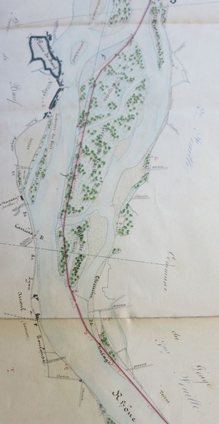
- Map/Long profile
- Période/Period
- 1842
- Secteur/Sector
- St-Clair-du-Rhône to Sablons (17,5 km long)
- Echelle/Scale
- 1/10 000
- Complément d'information/Additional information
- 1 map and 1 long profile
- Licence
- Creative Commons (BY-NC)
Données EXIF
Canon Canon PowerShot S110
- Make
- Canon
- Model
- Canon PowerShot S110
- DateTimeOriginal
- 2020:01:16 12:09:37
- ApertureFNumber
- f/2.0
Propulsé par Piwigo