
Accueil / OHM Vallée du Rhône / Archives cartographiques et topographiques /
Map (Anglefort to Caderousse, 1946-1983)
16/350
)
)
)
)
)
)
)
: Plans avant-travaux. English title: Pre-work plans.")
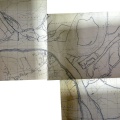
Original title (in French): Plans avant-travaux. English title: Pre-work plans.

- Auteur
- CNR
- Tags
- Fonds/Photographic fund
- Compagnie Nationale du Rhône (reference: NA)
- Contributeurs/Contributors
- Nature de la ressource/Resource type
- Map
- Date
- Période/Period
- 1946-1983
- Commune/Municipality
- Secteur/Sector
- Anglefort to Caderousse (366 km long)
- Echelle/Scale
- 1/10 000
- Lieu visé ou point de visée/Targeted place or photographer geolocation
- Projet OHM/OHM project
- Complément d'information/Additional information
- Ressource liée/Linked resource
- DOI
- Copyright
- Creative Commons (BY-NC)