
Accueil / OHM Vallée du Rhône / Archives cartographiques et topographiques /
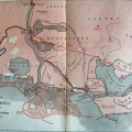
Map (St-Maurice-l'Exil to Piolenc, 1810-1832)
32/350
)
)
)
)
)
)
)
: Cadastre napoléonien. English title: Napoleonic land register.")
Original title (in French): Cadastre napoléonien. English title: Napoleonic land register.

- Auteur
- Napoleon I
- Tags
- Fonds/Photographic fund
- Archives Départementales de la Drôme, Archives Départementales de l'Ardèche, Archives Départementales du Vaucluse, Archives Départementales de l'Isère (reference: NA)
- Contributeurs/Contributors
- Nature de la ressource/Resource type
- Map
- Date
- Période/Period
- 1810-1832
- Commune/Municipality
- Secteur/Sector
- St-Maurice-l'Exil to Piolenc (160 km long)
- Echelle/Scale
- 1/10 000
- Lieu visé ou point de visée/Targeted place or photographer geolocation
- Projet OHM/OHM project
- Complément d'information/Additional information
- Collected by A. Barra in 2015. Municipal maps. AD38: 4 maps available on request
- Ressource liée/Linked resource
- DOI
- Copyright
- Creative Commons (BY-NC)