
344/350
)
)
)
)
)
)
)
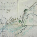
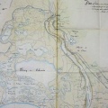
: Plan du projet de l'épi de Fourques et des plantations à faire sur les bords du petit Rhône. Fig. n°2 Plan général. English title: Plan of the Fourques spur project and the plantations to be made on the banks of the Petit-Rhône. Fig. n°2 General plan.")
Original title (in French): Plan du projet de l'épi de Fourques et des plantations à faire sur les bords du petit Rhône. Fig. n°2 Plan général. English title: Plan of the Fourques spur project and the plantations to be made on the banks of the Petit-Rhône. Fig. n°2 General plan.
- Autor
- Gorsse & Grangent
- Tags
- Fonds/Photographic fund
- Archives Nationales (France) (reference: CP/F/14/10074/1/A/piece29)
- Contributeurs/Contributors
- Nature de la ressource/Resource type
- Map
- Date
- Période/Period
- 1813
- Commune/Municipality
- Secteur/Sector
- Arles to the sea (51 km long)
- Echelle/Scale
- 1/5000
- Lieu visé ou point de visée/Targeted place or photographer geolocation
- Projet OHM/OHM project
- Complément d'information/Additional information
- Ressource liée/Linked resource
- DOI
- Copyright
- Creative Commons (BY-NC)
- Make
- Canon
- Model
- Canon PowerShot G9
- DateTimeOriginal
- 2018:07:23 06:32:18
- ApertureFNumber
- f/2.8