
301/1165
)
)
)
)
)
)
)
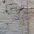
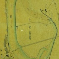
: Carte du Rhône entre Donzère et Arles. English title: Map of the Rhône river between Donzère and Arles.")
Original title (in French): Carte du Rhône entre Donzère et Arles. English title: Map of the Rhône river between Donzère and Arles.
- Author
- Ponts & Chaussées
- Tags
- Fonds/Photographic fund
- Archives Départementales du Rhône (reference: S 1225)
- Contributeurs/Contributors
- Nature de la ressource/Resource type
- Map
- Date
- Période/Period
- 1846
- Commune/Municipality
- Secteur/Sector
- Donzère to Arles (115 km long)
- Echelle/Scale
- 1/10 000
- Lieu visé ou point de visée/Targeted place or photographer geolocation
- Projet OHM/OHM project
- Complément d'information/Additional information
- Ressource liée/Linked resource
- DOI
- Copyright
- Creative Commons (BY-NC)
- Make
- i2S, Corp.
- Model
- SupraScanQuartzA0 [SN: 354501] - CamQuartzHD [SN: 354501]
- DateTimeOriginal
- 2018:05:02 11:58:10